These 77 towns, villages and sights in Malta will amaze you
The Republic of Malta with its six islands has as many inhabitants as Liverpool, Edinburgh, Lyon or Nuremberg. The history of Malta goes back 7,000 years. We have visited over 100 cities, towns, sights, events, festivals, and excavation sites for you. The hopefully 77 most exciting, impressive and sometimes almost unbelievable places written down as a short portrait for you. Click on your desired place and get excited about the fantastic stories. These articles will be updated.
Malta (without Gozo and Comino)
Little Malta has so much to offer. We will just briefly describe what to expect in the places and sites. About most of the sights and places, we will write a report about the fantastic stories and experiences in the medium term. For the headings, we have basically chosen the English name. In the glossary, we also give you the original name, should it differ. Background, with the search, with authorities or also bus connection, rarely only the Maltese designation is used. For example: Attard and Ħ’ Attard. The numbers of inhabitants are taken from the current census.
Attard (Three Villages)
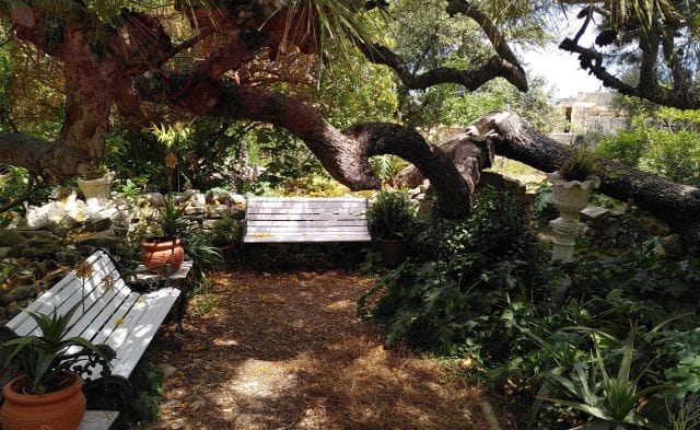
Ħ’ Attard belongs with Lija and Balzanzu to the Three Villages and is located in the center of Malta. The town of Attard, with 12,300 inhabitants (as of 2022), bears the name of Giovanni Attard, the builder of the Wignacourt aqueduct. The Wignacourt aqueduct ran from Mdina through Attard and supplied Valletta with fresh water since 1615. At about the same time, the Maltese architect Tumas Dingli had the parish church of St. Mary (1616) built. With its elaborate sculptures, it is considered one of the most beautiful Renaissance buildings in Malta. Since the beginning of the 17th century, the Knights of the Order of St. John built their country residences in Ħ’Attard. The residence of the Grand Master of the Order of St. John Antoine de Paule is the most impressive Sant’ Anton Palace built in 1623. According to the English governor of Malta, Sant’ Anton Palace is the residence of the President of Malta.
Open to the public since 1882, the baroque gardens with their tropical trees are a green, tranquil oasis around the palace. The railroad line from Mdina ran to Valletta via Attards station between 1883 and 1931. Wealthy families built summer residences in this exclusive urban area in the early years of the 20th century. In addition to Malta’s national stadium, Ta’ Qali Stadium, Attard is home to the headquarters of the Financial Services Authority. Other institutions include the embassies of the United States, Tunisia and China. The New Zealand Consulate General found its home in Attard, as did the Papal Nuncio with Aid to the Church in Need. Attard has a hospital.
Bahar Ic-Caghaq
North of Pembroke and Swieqi to the east is Bahar Ic-Caghaq. The small village with about 1,000 inhabitants (as of 2022) used to be a campsite of the British military and belongs to Naxxar. Bahar Ic-Caghaq is famous for its Mediterraneo Marine Park. If you don’t come across a dolphin now and then in the Maltese waters, you can swim with dolphins in the Mediterraneo Marine Park. Located right by the sea is the Splash and Fun Waterpark, popular with families. Near the beach, The White Rocks rises out of the water.
Balzan (Three Villages)
Ħal Balzan with its 4,800 inhabitants (as of 2022) belongs to the Three Villages with Attard and Lija. In addition to the old farmhouses, the church built in the 17th century in the shape of a Latin cross and an elegant dome is considered a point of interest.
.
Bird Park Kennedy Grove
Kennedy Grove Park near Salina off St Pauls (San Pawl Il-Baħar) has been home to over 200 species of birds since 2012. Discover the flamingos, pelicans, swans, owls, parrots and the other feathered residents of Bird Park that share Bird Park Kennedy Grove with peaceful mammals and reptiles.
Birgu (Thre cities)
Birgu was renamed Vittoriosa after the victory over the Ottomans.
Birkirkara
The city of Birkirkara is one of the most populous cities in Malta, with approximately 25,900 inhabitants (as of 2022). It is located in the center of Malta, between Attard and San Gwann. During the siege of Malta by the Ottomans in 1551 and the siege of the Grand Harbour in 1565, Birkirkara was twice heavily destroyed. Through Birkirkara ran the water supply Wignacourt aqueduct from Mdina to Valletta. The train stopped at the Old Railway Station between the two cities until 1931. There is a park near the Old Railway.
With no war-significant industry, Birkirkara was largely spared from air raids during World War II. This made Birkirkara, as Malta’s Emergency Capital, an important refugee camp from the Three Cities and towns on the Grand Harbour. Birkirkara has no direct access to the sea or beach.
Birkirkara is home to over a dozen churches and sacred buildings. Among them are the St. Rocque Chapel from 1593 and one of the most beautiful baroque churches in Malta, the Basilica Sant’ Elena (St. Helen Church). Pope Pius XII elevated St. Helen Church, with its eight-ton bell, to Basilica minor in 1950. The city, with many businesses for services and industry, has a very high traffic volume. For years, it has had by far the highest number of motor vehicle accidents in Malta. However, Birkirkara is exceptionally well served by bus.
Besides the DaVinci Health hospital, the Birkirkara Health Centre, the large university hospital Mater Dei Hospital is in the neighboring town of Msida. For the many events in Birkirkara, please see our WoM events calendar.
Birżebbuġa
Birżebbuġa is a port town in the south on Marsaxlokk Bay. It has a population of 11,900 (as of 2022). Birżebbuġa became famous for the fossil finds from the Ice Age in the Għar Dalam cave.
The church of Birżebbuġa is dedicated to St. Peter in Chains. Besides fishing, the container port Malta Europort is located in Birżebbuġa. The bay has one of the most beautiful sandy bathing beaches in Malta.
Bormla (Three Cities)
Bormla was renamed Cospicua after the great siege by the Ottomans in 1565. Please see our glossary entry Cospicua for more information.
Buġibba
This northern town is a popular neighborhood of St Paul’s Bay (San Pawl Il-Baħar). Historically, Buġibba does not offer much. A temple from the Tarxian period, as well as the Buġibba batteries of the Order of St. John.
Sandwiched between Qawra and St. Paul’s Bay is Buġibba, the second most popular party area in Malta and “important karaoke location”. From any point in Buġibba it is a few hundred meters to the sandy beach and sea. Café, bars, and restaurants are lined up there. The wide range of water sports such as surfing, SUP, jet ski or the diving schools Scuba Diving and Amazonia Complex complete the varied stay.
Buġibba can be reached quickly by public transport from many places on the island. The bus station is located in the neighboring village of Qawra. Buġibba’s rent level is significantly lower than St Julians, Sliema, Pietà, Pembroke or Swieqi. This makes Buġibba interesting for (language) students as a place to live. Prices for vacation accommodation such as hotels and flats are reasonable.
Buskett Gardens
Buskett Gardens is located next to Verdala Palace between Dingli Cliffs and Siġġiewi. The former hunting ground was laid out by the Grand Master of the Order of St. John, Lascaris. The Buskett Gardens consist of vineyards, orangeries, olive, and lemon plants. In our WoM calendar of events, we note the date of the traditional L-Imnarja festival. It is a folk festival and a harvest festival at the same time.
Cospicua (formerly Bormla, Three Cities)
The small town of Cospicua with 4,700 inhabitants (as of 2022) is the market center of the Docklands between Vittoriosa (Birgu) and Senglea (L’Isla). The Order of the Knights of St. John renamed Bormla, located to the southeast, Cospicua after the siege by the Ottomans. The great bastions of the Knights of Malta still exist. Cospicua is the largest town of the Three Cities on the Grand Harbour opposite Valletta. Part of the coast was occupied by the Malta Dockyard. An important naval base for centuries.
Under British occupation, it was home to the Royal Navy. During World War 2, the future Prince Consort of Queen Elizabeth II, the Duke of Edinburgh Prince Philip, served with the Royal Navy in Malta. Fort Sant Angelo and the Royal Navy Dockyard became a major air raid target for Axis Germany and Italy. Many citizens fled, so 70 years after WW2 there are still fewer people living in Cospicua than before the war. The shipyard has been restored and rented for 30 years by Palumbo Shipyardsals as a marina.
Famous and used for concerts is the Immaculate Conception Church, a collegiate church with magnificent works of art. The Cospicua Health Centre provides medical care.
Cottonera (Three Cities)
Grand Master Nicolas Cottoner had the fortifications of the Three Cities built in 1670. Since then, locals have called the Three Cities “Cottonera.” For more information on the Three Cities, see Cospicua, Lija and Senglea.
Dingli
Ħat Dingli with about 3,900 inhabitants (as of 2022) is located in the west of the island. Dingli is famous for the Dingli Cliffs, which are 240 meters above sea level. They are the highest place on Malta. Other attractions are mysterious cart ruts in the stone. Such are found on the south coast and in Xemxija on the Xemxija Heritage Trail. They date to the pre-Punic period and may be as old as 3,300 years.
The Buskett Gardens are the largest contiguous woodland in Malta. The village of Dingli has excellent restaurants, such as The Diar Il-Bniet in Dingli.
Fgura
Located in the south, l-Fgura is a young, fast-growing town with a population of 13,100 (as of 2022). The sixth-largest city in Malta is located between the Cottonera fortifications, Grand Harbour and the towns of Żabbar and Tarxien. Medical services are provided by the Paola Health Centre.
Filfla (Insel)
Filfla and its subsidiary island Filfoletta Rock are uninhabited island rocks off Żurrieq. The island, 6 hectares in size and rising 60 meters from the water, unfortunately has the shape of an aircraft carrier. Thus, it served the British Royal Air Force and the Royal Navy as a target practice area until the 1980s. Due to continuous bombardment, large parts of the island broke off. For safety reasons, an exclusion zone exists within one nautical mile (1.852 km) due to unexploded ordnance.
Fifla Island was the site of a chapel dating back to 1343, which was destroyed in an earthquake in 1856. Filfla and Filfoletta have been a bird sanctuary and resting place for the Filfola lizard (Podarcis filfolensis ssp. filfolensis) since 1980. Blue sharks are also spotted at Filfla Island. You can see Filfla excellent from the prehistoric temple complex Mnajdra. In the movie Popeye, the island can be seen as Gale (Scab Island).
Floriana
The most worth seeing suburb with a population of 2,000 people (as of 2022) off Valletta is Floriana. The Knights of St. John commissioned military engineer Pietro Floriani to expand Valletta’s fortifications in 1636. Floriana was a fortified town in front of Valletta. In the many open spaces, gardens, patrician houses and at the fantastic Floriana fountain, events take place continuously. You can find the music festivals, performances and Christmas market in our WoM events calendar. Other highlights include the Parish Church of St. Publius overlooking Granary Square and the Argotti Gardens on St. Philip’s Bastion.
In Floriana there are the confusing but important interchange bus stops Bombi 1 – 5. It is a few hundred meters to the main bus station. Medical care is provided by the Floriana Health Centre.
Fort Saint Elmo
Fort Saint Elmo was built in 1552 on the Aragonese watchtower. This was found unfit for defense after the Ottoman raid in 1551. Later, the fort was incorporated into the city walls of Valletta. In the siege by the Ottomans in 1565, they captured Fort Elmo.
Ghajn Tuffieha Beach (Ghajn Tuffieha Tower)
One of the greatest sandy beaches in the north of Mellieha. Not so popular with tourists, because a descent of over 200 steps is necessary to the sandy beach. And of course back up again. Ghajn Tuffieha Beach is located between Golden Bay and Gnejna Bay. Wonderful sandy beaches for a romantic sunset. Above the sandy beach is the Ghajn Tuffieha Tower from the time of the Knights of Malta.
Għar Dalam (Höhle)
The Għar Dalam Cave is located about 15 meters above sea level and has a length of 150 meters. Finds such as bones and remains of bats, giant swans, turtles, hippopotami and pygmy elephants are stored in the museum at Għar Dalam. The Cave of Darkness was the storage place for war materials during World War 2. During the bombing, the population found shelters there. Għar Dalam belongs to the European network of protected areas Natura 2000.
Ghaxaq
Għaxaq is located in southeastern Malta, near Luqa Airport. There are 5,600 people living in the farmhouses, some of which are up to 300 years old. Small alleys behind the parish church are typical of old Maltese villages. Għaxaq is located in a predominantly agricultural area. The baroque church with artwork from three centuries dates from 1756. Near the church is a picturesque house with shell and pebble decorations.
Golden Bay
Golden Bay beach is large in the bay, overlooking the sea and the rocks. In addition to several restaurants located directly on the sea, rental companies offer many water sports activities. Every evening the guests of Golden Bay admire the sunset on the sea. The golden sands often host Malta’s famous triathlons. Check the WoM events calendar to see if there’s a competition coming up.
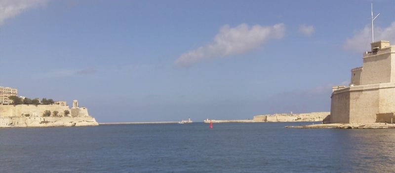
Grand Harbour
The natural harbor Grand Harbour is a branching bay with a varied history. For Phoenicians, Punic, Romans, Byzantines, Arabs, Spaniards and the Order of St. John, Grand Harbour served as an anchorage. The Phoenician fortifications were extended by the Knights of St. John to form Fort St. Angelo. In 1552, under the orders of the Grand Master Claude de la Sengle, fortified the adjacent peninsula with Fort St. Michael. During the carnival season, decorated galleys sailed the Grand Harbour.
From Grand Harbour, the catamarans and ferries leave Malta daily for Sicily. The gigantic luxury liners (cruise ships) can be found and heard along the waterfront. Every half hour, the ferry shuttles between Gozo and Valletta. With gondola-like ships, you cross the Grand Harbour to the Three Cities. Want to know more about the Grand Harbour? Harbor tours of the Grand Harbour are offered from several locations in Malta.
Gudja
Between Sliema and Msida is Gudja, with 3,300 residents (as of 2022). The Ħal Resqun catacombs were built circa 400 years after Christ. The first houses were built during the Order of St. John. Next to the palace Palazzo Dorell there is a tower built in 1780. During the occupation by Napoleon’s French, Palazzo Dorell served as headquarters for the British forces under General Graham. Another place of interest is the 15th century Bir Miftuħ Chapel.
Gzira
Between Sliema and Msida, on the western side of Marsamxett harbor, is the town of Il-Gżira. The town, with a population of 10,300 (as of 2022), has a long seafront promenade at the port. It passes by the Manoel Island. You can shorten the way around the harbor area to Valletta with a romantic trip through the harbor basin by ferry from Gzira every half hour. Il-Gżira is well connected to public transport in all directions and has a Gzira Health Centre.
Ħaġar Qim (prehistoric temples)
See our report under Mnajdra. Both are part of Malta’s prehistoric temple complexes.
Ħamrun
Ħamrun has a population of 10,600 (as of 2022). It is located in the east near Valletta and Pietà. From the Punic period are archaeological finds carved into rocks tombs. For the Order of St. John, Ħamrun was a hunting ground. The main street St. Joseph High Street is an important shopping street in Malta. The name originated in 1881 with the settlement of a parish. Ħamrun was a refuge for the port population during the Second World War.
Ibrag
Tal l-Ibraġ belongs to Swieqi with Madliena and part of St. Andrews. Victoria Lines are located a few kilometers away. Tal-Ibraġ has a small chapel.
Iklin
L-Iklin is a relatively modern town located between Birkirkara, Naxxar and Lija. Iklin was separated from Lija in 1985. The chapel has existed since 1615, although Ilkin was not built until 1958. Remains of a temple (Tar-Raddiema) and pottery shards have been found in excavation sites, as well as a Roman country house.
Isla (Three Cities)
L-Isla is a peninsula and city in the southwestern part of Grand Harbour. It is part of the Three Cities. The Grand Master of the Order of St. John, Claude de la Sengle, renamed it Senglea. For more details and the Basilica minor, see the glossary entry Senglea.
Kalkara (Three Cities)
Officially, Kalkara’s 3,200 residents are not part of the Three Cities. However, they share a similar historical and economic background. Near Kalkara is the massive Fort Ricasoli as the entrance to the Grand Harbour, built in 1670. Kalkara is famous for its Mediterranean film studios. Scenes from “Das Boot”, “U-571” and “Raise the Titanic” were filmed there in huge water basins. The British Royal Naval Hospital is now a training center for restoration studies.
Lija (Three Villages)
Ħal Lija is part of the Three Villages Attard and Balzan. The 3,200 residents (as of 2022) are supplemented by wealthy families with their summer residences. Lija, with its winding alleys and large villas, was once the orchard of Malta. Ħal Lija has some architectural monuments, such as an old parish church built in 1691. The small chapel built by Giovanni Barbara is dedicated to the Blessed Virgin (Tal-Mirakli).
Luqa
Ħal-Luqa (Maltese ĉ Luqa) is at Malta International Airport. 5,100 inhabitants live there. Nearby are the underground temples hypogeum of Ħal-Saflieni. These impressive attractions are up to 6,000 years old. The 15th century church is dedicated to St. Andrew.
Since 1993, The Malta International Air Show has been held at the end of September. It is the largest outdoor event in Malta and one of the best family events. The planes fly for hours from Luqa to St Pauls Bay and back. In 2006, Colonna Mediterranea, colloquially known as Luqa Monument, was inaugurated. Because of the airport, Luqa has a very good bus connection.
Madliena & Madliena Tower
Madliena (Maltese Il-Madliena ) belongs to Swiqui. The city name is known because of the British Empire built Fort Madalena (Madliena) in 1878 and the Madliena Tower. The latter is located between Fort Pembroke and Fort Madliena and was built by the Knights of St. John.
Manikata
Manikata is a small village on the border with Mellieħa. Throughout the year farmers grow vegetables, lettuce and fruits such as grapes, watermelons. Apples, strawberries and pomegranates. The church designed the renowned Maltese architect Richard England and is dedicated to St. Joseph.
Marsa
Marsa (or Il-Marsa) is located on the southernmost part of the Grand Harbour. The town, with a population of 5,500 (as of 2022), borders Paola, Qormi, Ħamrun and Floriana. In addition to the Malta Shipyards and the Malta Race Course harness racing track, the Marsa and Delimara coal-fired power plants produce electricity for Malta and Gozo. Car production Car Assembly was discontinued in 1981. During the siege of the Ottomans were on the flat area with wells their field camps.
Marsaskala
Marsaskala (Wied il-Għajn) is a town of 16,800 inhabitants (as of 2022) at the inner end of Marsaskala Bay (Marsaskala Creek). It may be several thousand years old. There are Christian catacombs and Roman villas. The watch towers St Thomas Tower, De Redin Watch Tower and Der Torri Mamo were built by the Knights of the Order of St John after the Ottomans landed on Marsaskala again in 1614.
Marsaxlokk
Marsaxlokk Bay is Malta’s second-largest natural harbour and the Sunday fish market a tourist destination in the morning hours. Marsaxlokk is Malta’s most important fishing port, with a population of 4,000 (as of 2022). Two attractive bays invite for swimming. Famous is Peter’s Pool and in the west Fort Delimara. In 1989 Marsaxlokk attracted worldwide attention at the Bush-Gorbachev summit.
Mdina
The history of Melita dates back over 2,000 years. Possibly the name Melita was derived from the terms Malet = place of refugeand and Mel = honey. After the retreat of the Romans, Melita was renamed L-Imdina (short for Mdina) by the Arabs. The suburb outside Mdina’s fortified walls is Rabat (suburb). Mdina is a fortified medieval city and former capital of Malta. The narrow streets, less than 200 inhabitants, fascinating views to the sea and car-free city made Mdina to “Silent City”.
Mellieha
Il-Mellieħa has been inhabited again since the 18th century. Its 12,800 residents have one of the most picturesque churches. Paris Church towers over Mellieha with a panoramic view of Mellieħa Bay, Gozo, Comino, the sea and the surrounding countryside. Under the Paris Church, next to air raid shelters from World War 2, is the national shrine, the Chapel of the Holy Virgin. Il-Mellieħa is a modern town with breathtaking views of Mellieha Bay (Għadira). Due to its sandy beach, proximity to Golden Bay, Gozo and Comino’s Blue Lagoon, Mellieha is an extremely popular resort. In winter, it is quiet. The bus connection to the north leads to the ferry port, Cirkewwa.
Il-Mellieħa has been re-inhabited since the 18th century and was founded by the British in 1844 as the municipality of Mellieha. In ancient writings Mellieha is noted for 5,000 years. Probably from a derivation of the Arabic word for salt, m-l-h, that was extracted from the Punic and Roman salt flats. The 12,800 residents have one of the most picturesque churches. Paris Church towers over Mellieha with a panoramic view of Mellieħa Bay, Gozo, Comino, the sea and the surrounding countryside.
Under the Paris Church, next to air raid shelters from World War 2, is the national shrine, the Chapel of the Holy Virgin. Il-Mellieħa is a modern town with breathtaking views of Mellieha Bay (Għadira). Due to its sandy beach, proximity to Golden Bay, Gozo and Comino’s Blue Lagoon, Mellieha is an extremely popular resort. In winter it is quiet. The bus connection to the north leads to the ferry port of Cirkewwa. In the north towers The Red Tower or Ford St. Agatha, One, of seven towers of the Grand Master of the Knights of Malta Lascaris. Later, the White Tower, Armier Redoubt and L-Ahrax Tower were added to the north.
Mnajdra (prähistorische Tempelanlagen)
The temple complexes and Mnajdra and Ħaġar Qim in the south of Malta are circa. 6,000 years. They have been UNESCO World Heritage Sites since 1992.
Mosta
Il-Mosta, derived from the Arabic “Musta” (center), is one of Malta’s largest three and oldest cities, with a population of 23,500 (as of 2022). It borders the British fortifications Victoria Lines. Mosta has prehistoric remains from the Bronze Age dating back as far as 4,100 years. The magnificent domed church of Mosta Rotunda is one of the largest church domes in the world. The Maltese architect George de Vasse wanted to imitate the Pantheon in Rome. During World War II, an aerial bomb hit the cathedral during mass, but it did not explode. It was elevated to basilica minor by Pope Francis in 2018. Under the Bażilika ta’ Marija Mtellgħa s-Sema there is a shelter from the 2nd World War, which can be visited. Next to the church, also in the center of Mosta, is the Mosta Health Centre.
Mqabba
Mqabba, with a population of 3,600 (as of 2022), is surrounded by quarries. Sights are
- the Vincenti Tower,
- the Chapel of St. Basil
- the Chapel of Our Lady of Sorrows (Maria),
- the Chapel of St. John
- and of St. Catherine.
The dates of festivals such as Santa Marija or Our Lady of the Lilies can be found in our WoM calendar of events.
Msida
L-Imsida (Arabic “Msayda” for fisherman’s dwelling) hosts up to 250 yachts in the modern Msida Yacht Marina. 13,600 citizens (as of 2022) live in L-Imsida. Besides a washing place in a vault for the local population of a leading German knight of the Order of St. John, the special attractions are the pleasant walks through the marina, a unique cave chapel and the elegant baroque church of St. Joseph’s.
Naxxar
Historic Naxxar is located along the British Victoria Lines fortification in northern Malta. The ruins of the megalithic temple of Tal-Quadi are from the Stone Age. St. Paul is said to have preached in Naxxar after his shipwreck in 60 AD. The 17,000 inhabitants (as of 2022) have Naxxar Church Our Lady from the 17th century, one of the tallest baroque buildings in Malta. Windmills, two round fortress towers and a church museum with processional statues are further attractions in Naxxar. One was donated by the Vatican. Baħar iċ-Ċagħaq and Salina are part of Naxxar.
The lavish Palazzo Parisio with a unique mansion was donated by a Maltese entrepreneur. In Naxxar there are colorful procession and events at Palazzo Parisio and Our Lady church. Naxxar, like all ancient towns, has visible cart ruts in the stones. They occur in many other parts of Malta. They date from the pre-Punic period and may be as old as 3,300 years. Annually the Malta International Trade takes place in Naxxar (more activities on Naxxar WoM events)
Paceville
Paceville is a district of St. Julians (San Ġiljan). It is Malta’s largest entertainment district. Discos, bars, nightclubs, food stalls as well as restaurants and cafes can be found in the middle of the residential area. Next to the large and luxurious 5-star hotel The Westin is St. Georges Bay.
Paola
Paola was founded by Grand Master of the Order of St. John Antoine De Paule in 1623. In 1630 the foundation stone of the Holy St. Ubaldesca Church was laid. It was replaced around 1900 by the Sacred Heart of Jesus Church. Other sites of interest include Christ The King Church of 1924, the Kordi Plateau and the underground burial and temple sites Hypogeum of Ħal-Saflieni. Paola’s church Bażilika Kristu Re became the twelfth church to be elevated to Bascilia minor by Pope Francis in 2020. Paola has belonged to Fgura since 1967 with the Paola Health Centre.
Pembroke
Pembroke is one of the youngest towns in Malta, with 3,600 inhabitants (as of 2022). It is located northeast under Naxxar and St. Pauls Bay and borders the residential areas of Swieqi and Ibraq. Ford Pembroke was built by the Knights of St. John to defend the Grand Harbour to the south. The British occupiers further developed Ford Pembroke into barracks between 1859 and 1862. Named for Robert Henry, the 12th Earl of Pembroke and British Secretary of War in 1859, German prisoners of war at Fort Pembroke built a small chapel for the British soldiers. Pembroke is home to an international school for IGSCE and IB programs. Landmarks include Madliena Tower and Tower Pembroke, in addition to Ford Pembroke.
Pieta
Valley Pietà (Italian piety) was the residence of Princess Elizabeth, later Queen Elizabeth II, the Villa Guardamangia. Pietà has 5,900 inhabitants (as of 2022) and is a suburb of Msida and Valletta. Pietà adjoins Floriana directly to the west. Prior to the construction of Mater Dei Hospital, the Maltese government hospital St. Luke’s Hospital was located in Pietà. In the 17th century, the small chapel of Our Lady of the Sorrows was built.
Ferries depart from Pietà to Gozo and Sicily. Maltese Navy patrol boats are anchored at Haywharf. Other points of interest:
- National television station,
- Ta’ Braxia cemetery complex of British veterans of the world wars.
Playmobil FunPark
For a fun-filled family day, visit Playmobil FunPark and tour the Playmobil factory. Since 1974, Geobra Brandstätter GmbH has been producing Playmobil toys in Hal Far with up to 1,000 employees. In the Indoor & Outdoor Castle you can book children’s parties, take part in fun and educational school trips or visit the End of school celebrations or End of Summer Party. Check our WoM events calendar for the annual date.
Popeye Village
Popeye Village is a former movie location about two kilometers west of Mellieħa. The movie location has been developed as Popeye Village Fun Park. There are regular events for children and families. Anchor Bay is great for swimming. Props from the movie can be seen in some houses. The cinema provides information about the set construction and the Popeye movie. The group of islands in the south of Filfla was part of the Popeye movie as Scap Island.
Qawra
Il-Qawra (Maltese [ʔawra]) is a district of St. Paul’s Bay in northern Malta, along with Buġibba. The Order of St. John built the Qawra Tower at Qawra Point and a cannon battery. At the bulwark built in about 1760 and in the Qawra Tower is the restaurant Ta’ Fra Ben.
Across Salina Bay and its salt pans (salt pans) is the town of Salina. Qawra is a popular resort with many hotels and restaurants and the famous National Underwater Museum Aquarium. In addition to visiting the casino at Oracle, water sports activities include banana boat, speed boat, jet ski, Stand-Up paddle and kayaking.
Qormi
Ħal Qormi or Città Pinto is the fifth largest town in Malta with a population of 18,100 (as of 2022). Bronze Age burial sites show that the Phoenicians were already trading with the population. In the middle of Malta, Qormi borders Attard and Haz-Zebbug. In summer, the population celebrates two weeks in honor of the patron saints of St. George and St. Sebastian. We publish the date in the WoM calendar of events. The town is famous for its Good Friday processions. Health care is provided by the Qormi Health Centre.
Rabat (bei Mdina)
To the west are Ir-Rabat and the village of Baħrija with 12,000 inhabitants (as of 2022). The most charming town belongs only to the medium-sized, towns of Malta. Rabat is separated from the former capital Mdina by a park. Its 2,000-year history begins with the Romans and Apostle Paul, who was stranded on St. Paul’s Island on his way to Rome and spent much time in Rabat, Mosta, and Naxxar. At that time, Mdina and Rabat were united as Melita. The Arab occupiers drew a protective wall around Mdina, leaving the suburb of Rabat unprotected for the common people.
In the sanctuary of St. Paul Church is the three-nave Baroque basilica. A high altarpiece, depicts the shipwreck Apostle Paul. Pope Francis honored the Bażilica Kolleġġjata u Proto-Parrokkjali ta’ San Pawl 2020 with the elevation to the status of Basilica minor. Under the church in the Pauline Grotto, the saint is said to have lived and taught. Pope John Paul II, prayed in the Pauline Grotto. The St. Agatha Catacombs were built after the 3rd century.
In our WoM events calendar, you can find the festivals of Rabat and Mdina. On some festival days the history of Rabat and Mdina is re-enacted. The Crystal Palace in Rabat is famous for the best pastizzi in Malta. The Maltese dish Pastizzi are crispy and light-as-air puff pastries. They are filled with chopped peas or with ricotta cheese and a size of about 16 × 10 cm. A pastizzi costs between 30 and 50 cents. For the price, you can get up to 2 packets of ketchup at Mcdonalds or Burger King.
Salina
Ir Salina is a neighborhood of Naxxar. Nearby is Kennedy Grove Park. in Salina Bay, salt pans are used to wash out salt. From Salina there is a magnificent view of Qwara.
San Ġiljan
The official name of St. Julians.
Safi
The Phoenicians and the Romans lived on Safi before Ħal Safi was first recorded in the southwest of Malta in 1419. Of the five chapels in the town of1,900 inhabitants (as of 2022), there is the Chapel of the Assumption, built in 1761. There has been a hospital in Safi since 1986.
San Gwann
San Gwann has 14,300 inhabitants (as of 2022) and has existed since the 3rd century AD. At that time tower was built Roman Tower in Ta’ Ċieda, one of eight defense towers. Due to the hill, there is a good view of the Grand Harbour from San Gwann, which was last used during the siege of the Maltese troops of Valletta in 1798-1800 against the French.
Places of interest include the Tal Mensija Church, the 1713 It-Torri la’ Lanzun and Ta’ Xindi fortified courtyards in the suburb of Kappara, an underground mill and the Church of Our Lady of Lourdes. Also in San Gwan, cart ruts from the pre-Punic period can be found, as in Dingli, Naxxar and Xemxija.
Senglea (Three Cities)
The former L-Isla, with 0.25 square kilometers, is located on the Grand Harbour opposite Valletta. With Birgu (Vittoriosa) and Bormla (Cospicua), Senglea with 2,300 inhabitants (as of 2022) makes up the Three Cities (Cottonera). On the borders is Galley Port with the marina and French Creek with its shipyards on the side to Marsa. The oldest building Senglea is St. Julian’s Chapel of 1311, almost destroyed by the earthquake of 1693 and rebuilt in 1712. During the Second World War it was almost the only building to remain undamaged.
The Knights of the Order of St. John prevented access to the peninsula with the construction of Fort St. Michael. After the protection provided by the walls, a large number of residential houses were built. The fort was defended against the Ottomans and after the victory it was named Città invicta. L-Isla was named after the name of the Grand Master of the Order of Malta, Claude de la Sengle. HMS Magpie had Senglea as its anchorage. Captain of the frigate was the Duke of Edinburgh, Prince Philip, husband of Princess Elizabeth, later Queen Elizabeth II.
Other landmarks include the Basilica of Nativity of our Lady and Saint Phlip’s Chapel, built in 1596. Bażilika Twelid tal-Vergni Marija (Basilica of the Nativity of Mary) became the third church to be elevated to basilica minor by Pope Benedict XV. Due to warships in the docks, such as HMS Illustrious, Senglea was nearly destroyed by bombardment from Axis Germany, and Italy. The Basilica Our Lady of Victory was rebuilt in 1957. In addition to bus services, you can reach the Three Cities by gondola-like vessels as well as the ferries of the Valletta Ferry System. They dock at the quay near the Maritime Museum in Birgu.
The Three Cities offer a variety of events with regatta in Grand Harbour, Good Friday procession,
Siġġiewi
Siġġiewi is located on a plateau in southwestern Malta and is home to 9,400 inhabitants (as of 2022). A few kilometers away from the former capital Mdina, Rabat, Buskett Gardens and Dingli Cliffs. Siġġiewi originated from the villages of Ħal Xluq, Ħal Kbir, Ħal Niklusi and Ħal Qdieri in the 14th century. In 1676, the Maltese master builder Lorenzo Gafà designed the Baroque church of St. Nicholas of Bari. Some chapels of the former villages are still preserved. From the coast of Siġġiewi you can see Filfla, the subsidiary island of Filfoletta Rock and the Summer Palace of the Inquisitor, the residence of the Prime Minister.
Sliema
The former fishing village of Sliema (Peace), with a population of 19,700, connects St. Julians and Gzira with a mile-long seafront promenade. During the siege of Malta, the Ottomans of il-Qortin fired their guns at Fort St Elmo. The Ottoman tent camp was on il-Qortin. Sights, besides the battery guns, are the churches of In-Nazzarenu and Sacro Cuor, dedicated to the Blessed Virgin,
Sliema is a vibrant city. A summer resort for Valletta’s wealthy residents, Sliema is a center for shopping, restaurants, cafés, hotels, and businesses. The promenade is used by joggers, inline skaters and walkers until the evening hours. Numerous cafés and restaurants with soothing views of the open sea make Sliema’s promenade a convivial meeting place for tourists and locals alike.
St George’s Bay
St George’s Bay in St Julians is popular. From the surrounding hotels, language schools and restaurants, you can reach the sandy beach in a few minutes. Due to the proximity to the entertainment district of Paceville, the beach is well frequented during the summer nights. St Georges Bay is very well-connected to Malta’s bus service.
St. Julians
San Ġiljan started as a fishing village. Due to its diversity, St Julians is one of the most popular places on the island. The medium-sized town with a population of 11,700 (as of 2022) offers a variety of cafés, restaurants and pubs, as well as…
- With St George’s Bay, Il-Quallet, Spinola Bay, St Julians Bay and Balutta Bay sufficient and varied beaches and water sports facilities.
- A beautiful beach promenade over 2 km to Sliema.
- The largest entertainment area in Malta in the Paceville district between St. George’s Bay and Spinola Bay.
- Dragonara Palace or Villa Dragonara, the largest casino in Malta right by the sea.
- A variety of low budget as well as luxury hotels like Intercontinental or Westin.
- In the largest building in Malta, Portomaso Tower, there is one of the largest sports and fitness clubs, as well as casinos and casinos.
- At the Hilton Hotel, the exclusive Marina yacht harbour.
- Large shopping center Baystreet.
- Worth seeing the Church of Our Lady of Mount Carmel.
St. Pauls Bay
San Pawl Il-Baħar in the north is the largest city in Malta with over 32,100 inhabitants. San Pawl Il-Baħar includes Buġibba, Qawra, Xemxija and Mistra. The disciple Paul is said to have been stranded at St Paul’s Island near Mellieha 60 years after Christ on his journey from Caesarea to Rome. Rescued by fishermen, Paul taught Catholicism to the Maltese. St Pauls, Buġibba and Qawra host a variety of events, some lasting several days. The fishing village, it is now a popular tourist destination, like Marsaxlokk.
St Paul’s Island (Insel)
The uninhabited St Paul’s Island is located a few meters from the coast of Mellieha. According to history, Apostle Paul was shipwrecked 60 years after Christ. After Malta’s inhabitants took care of him, Paul and his fellow travellers introduced the Maltese to Christianity, he continued his journey. Paul is said to have stayed for a long time in Rabat and Mosta. Since the 19th century, widely visible on St Paul’s Island stands the Statue of Saint Paul.
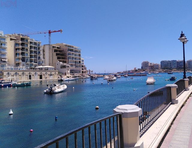
Swieqi
Is-Swieqi (irrigation canals) is close to the coast in the east of Malta. The Victoria Lines are a few kilometers away. In the Middle Ages, Swieqi belonged to the municipality of Birkirkara. An illegal builder named Augustinu Borg was the first inhabitant from about 1520. Swieqi has been considered a preferred address for high society since the 1980s. Farmhouses and a group of villas created a medium-sized town with 13,100 inhabitants (as of 2022). From some houses, the view is possible up to Valletta. So all fireworks from St Julian over Sliema, Gzira and Valletta are in view. Swieqi includes the villages of Ta’ l-Ibraġ, Madliena and parts of St Andrews. Madliena owes its name to the Chapel of St. Magdalene, built in the 15th century.
Paris Church is dedicated to Our Lady of the Immaculate Conception. In her honor, Swieqi celebrates Mass and a small procession each Dec. 8. Swieqi Paris Church began with the laying of the cornerstone on May 7, 1964. It was enlarged in 1995. You will hear a chime of several minutes at 8am and 8pm each day.
Tarxien (Tempel)
Tarxien is known for its prehistoric temple complexes dating back to the Copper Age. The “Fat Ladies” of Tarxien are huge statues and are in the National Museum of Archaeology in Valletta. The important Roman city has one of the oldest churches in Malta, the Tar-Rokna.
Ta' Xbiex
Ta ‘Xbiex is a peninsula overlooking the port of Marsamxett. Formerly a small fishing port with a population of 2,100 (as of 2022), its name is of Greek origin. Ta’ Xbiex offers a magnificent view over the marina of Msida Creek to the bastions of Valletta. The large villas on the coast are embassies, administrative buildings and offices. Not every country has its own embassy building. Spain, Germany, Netherlands, and Ireland are housed in the same building,
The Three Cities
The Three Cities consist of the three cities
- Cospicua, formerly Bormla
- Vittoriosa, formerly Birgu
- Senglea, formerly L-Isla
The short name for Three Cities is Cottonera. The city of Kalkara, with its film studios, is not part of the Three Cities. However, it borders and was the entrance to the Grand Harbour with Fort Ricasoli.
Upper Barrakka Gardens
Upper Barrakka Gardens is a man-made park between Valletta and Floriana. It offers a great overview of Malta. The romantic gardens were laid out by the Knights of St. John in 1661, but were not opened to the public until 200 years later. In addition to the diverse flora, the traditional cannon—firecracker takes place daily at 12 o’clock.
Valletta
Valletta bears the name of its founder, Grand Master of the Order of Saint John, Jean Parisot de la Valette. The European city of art of 1566 is a World Heritage Site. The fortified city of Citta ‘Umilissima, with a population of 6,800 (as of 2022), is Malta’s capital on the dry rock of the Mount Sceberras peninsula, with two harbors, Marsamxett and Grand Harbour. The Baroque masterpiece has a rich historical past. The two churches Parrocca Matrici u Bażilika Madonna tal-Porto Salvo u San Duminku and Santwarju Bazilika tal-Madonna tal-Karmnu were granted the status of basilica minor by the respective popes.
Vittoriosa Three Cities)
Vittoriosa is part of the Three Cities with a population of 2,300 (as of 2022). It is home to Fort St. Angelo. Birgu was built by the Dominicans in 1528. When the Order of St. John was looking for a capital in the south instead of Mdina, Birgu was chosen. After the victory over the Ottomans, Birgu was given the honorary name of Vittoriosa, the Victorious.
Besides the Church of St. Lawrence, the Palace of the Inquisitor, the mighty Fort St. Angelo are the two Malta Maritime and Malta at War Museum to visit. The Freedom Monument in front of St. Lawrence Church was built for the withdrawal of the British from Malta.
Xemxija
Ix-Xemxija is a magnificent place in the north of Malta. Like Buġibba and Il-Qawra Buġibba, it belongs to St. Paul’s Bay. Next to the small port of Xemxija Bay, the Roman Pilgrimage Trail is a trip in time between the Stone Age and modern times. On the Xemxija Heritage Trail you can expect to see a Roman road, fieldstone walls, the Cave of the Galleyn, apiaries from the Punic-Roman period, a Roman bath in a rock cave and temples from the Stone Age. There are well over 20 unique relics from some 5,000 years of history on the Xemxija Heritage Trail. The mysterious cart ruts from Buskett Gardens and southern fishing villages are also present on this trail. They date from the pre-Punic period and may be as old as 3,300 years.
Zabbar
Ħaż-Żabbar has 17,200 inhabitants (as of 2022) and is known from the battle between Napoleon’s troops and Malta’s at the church of Żabbar. French cannonballs can be found in the walls of houses there. Ħaż-Żabbar has a church museum, Our Lady of Graces Church, Fort San Rocco and Fort St Leonardo. On October 14, 1975, a military plane exploded over the city.
Żebbuġ
In 1777, the Grand Master de Rohan of the Knights of St. John elevated Ħas-Żebbuġ to city status. Still recognizable today by the monumental arch on the main access road. Ħaż-Żebbuġ (Village of Olives), with a population of about 13,800 (as of 2022), was an important agricultural village in the middle of Malta for centuries. You will find there some splendid patrician houses and palaces, as well as fine examples of domestic architecture from the 16th to 18th centuries. The 17th century church of Żebbuġ is dedicated to St. Philip. It is said to have been built by the son of the Maltese architect of St. Johns Co-Cathedral in Valletta. You will still find numerous chapels in Żebbuġ dating back to 1539.
Zejtun
Iż-Żejtun has 12,500 inhabitants and borders Marsaxlokk to the south. Known in the Middle Ages as le terre di Santa Caterina (land of St. Catherine). The war against the Ottomans began in Żejtun. The stationed militia regiment resisted for a long time. A Roman villa, the church with consecration of St. Catherine of Alexandria and the public Luqa-Briffa garden are other sights.
Zurrieq
Żurrieq is the largest city with a population of 12,300 (as of 2022) in the south. Landmarks include the spectacular coastline, the picturesque port of Wied iż-Żurrieq and the Blue Grotto (Blue Grotto). In Żurrieq’s surroundings there are many archaeological and historical sites dating back to Roman and Punic times. Off Żurrieq is the uninhabited archipelago of Filfla.
Stunning landscapes at Gozo and Comino
Besides hiking, Gozo is great for rock climbing and half-day or full-day bike rides along the coasts. The ferry to Cirkewwa runs 24 hours. To Valletta during the day.
Azure Window at Dwejra Bay
Gozo’s landmark Azure Window collapsed in 2017. Nevertheless, Dwejra Bay is suitable for a visit. From a pond located in a cauldron, you can swim through a tunnel directly into the cool sea. As a “substitute” for the Azure Window is the little known Wied Il-Mielaħ.
Comino (Insel)
Comino is the smallest of the three inhabited islands in Malta. Officially, four people live on Comino throughout the year. The Santa Marija Gun Battery served as protection against pirates.
Between Comino and the uninhabited island of Cominotto is the fantastic Blue Lagoon. Known from the movie Troy with Bratt Pitt and Swept Away (Stormy Love). St. Mary’s Tower, visible from afar, was the prison of The Count of Monte Cristo.
If you do not visit Comino by swimming, Stand-Up paddle or kayak, there are many ferry connections between 7 a.m. and 7 p.m. from Cirkewwa and Gozo, as well as Sliema and Valletta. Comino is suitable for walks of several hours.
Cominotto (Insel)
The uninhabited island rock Cominotto (Maltese Lemmunett) is located between Malta and Comino. You can reach Cominotto swimming from Comino or by SUP and kayak. The Cominotto Reef is known to insiders as a diver’s paradise. You can see Cominotto from the south of Mellieha and ferry port Cirkewwa.
Ggantija (Temple)
The Ggantija temples were created by giants. With an age of up to 3,600 BC, they are among the oldest freestanding buildings in the world. Since 1980 they belong to the UNESCO world cultural heritage.
Nadur
Nadur is not only the carnival stronghold on Malta. In the west live the 4,600 inhabitants with beautiful cliffs and hiking trails the Maritime Museum Lord Nelson’s ship “HMS Victory” or golden epaulettes of Lord Mountbatten. The church Bażilica San Pietru u San Pawl (Basilica of St. Peter and St. Paul) was elevated to the status of basilica minor by the Pope in 1967.
Qala
Südöstlich auf der Insel Gozo befindet sich l-Qala mit 2.300 Einwohnern (Stand 2022). Neben der restaurierten Ta’-Randu-Windmühle befindet sich die eindrucksvolle Parish Church of the Immaculate Conception and St. Joseph, kurz San-Ġużepp St. Joseph.
Ramla Bay, Tal-Mixta Cave & Calypso Cave
Ramla Bay is certainly one of the most beautiful three sandy beaches in Malta. The unique orange-reddish color of the sand, views of the historic Calypso Cave and beautiful blue waters. From Calypso Grotto and Tal-Mixta Cave, you have an excellent panoramic view over parts of Gozo. Tal-Mixta Cave served as a natural fortress for the Knights of St. John.
Saltpans of Gozo
Gozo sea salt has been extracted from the salt pans in northern Gozo during the summer months since the 17th century. You can recognize the salt pans by checkerboard shape for giants near Marsalforn. The water evaporates in it
Victoria, Ir-Rabat
Rabat (other name Victoria) is the capital of Gozo and 7,300 inhabitants (as of 2022). Famous is the citadel in Victoria. It stands on the highest point in Victoria and can be easily seen from every side of the island. Gozo’s citadel served as a refuge for the inhabitants for centuries. Until 1637 the citizens of Gozo had to spend the night in the citadel for protection.
Few people live within the walls of the citadel. It was extensively restored from 2007 to 2014. From the fortress walls, there is a 360-degree panorama over Gozo’s hills and valleys, villages, churches to across the sea to Malta.
In addition to the Cathedral Museum, the Museum of Archaeology, the Folklore Museum, the Nature Museum of Gozo, there is an old prison, grain silos and air raid shelters from World War II. The Bażilica San Gorg at Pjazza San Ġorġ became the sixth church in Malta to be elevated to the status of basilica minor in 1958.
Wied Il-Mielaħ Windows
Wied il-Mielah Window (Maltese Tieqa tal-Wied il-Mielaħ) is a popular destination for tourists and climbers. The Wied Il-Mielaħ Windows is a climber’s paradise for bouldering. In the north of Gharb a popular place for selfies. Easily accessible by bike and on foot from Gharb. The gate in the north of Gharb was formed by environmental influences.
Xaghra
Xaghra has 5,200 inhabitants (as of 2022).
Sights include the Ta Kola windmill from 1725, a toy museum and the Bażilica Marija Bambina. In 1967 Il-Bambina was named the eighth basilica minor in Malta by Pope Paul VI.
Xlendi, the small seaside resort on Gozo
Xlendi is a small but very popular bathing resort with a sandy beach on Gozo.
Quick search of the cities and sights via Google Maps
The largest cities in Malta with more than 1,000 inhabitants (as of 2022)
Thanks to Census, the Maltese government now also knows how many inhabitants live in Malta. This is because not everyone who leaves Malta for good, deregisters with the Maltese authority. During the closure of COVID-19, this was impossible for many an immigrant. From 2011, Malta has grown from 417,432 people to 519,562. Thus, Malta remains the country with the fifth-highest population density in the world. We have identified the largest 65 cities and towns for you.
- San Pawl Il-Baħar 32,042
- Birkirkara 25,807
- Il-Mosta 23,482
- Tas-Sliema 19,655
- Ħal Qormi 18,099
- Ħaż-Żabbar 17,148
- In-Naxxar 16,912
- Marsaskala 16,804
- San Ġwann 14,244
- Ħaż-Żebbuġ 13,785
- L-Imsida 13,587
- Il-Fgura 13,066
- Is-Swieqi 13,044
- Il-Mellieħa 12,738
- Iż-Żejtun 12,409
- Iż-Żurrieq 12,295
- Ħ’Attard 12,268
- Ir-Rabat 11,936
- Birżebbuġa 11,844
- San Ġiljan 11,653
- Il-Ħamrun 10,514
- Il-Gżira 10,331
- Ħal Tarxien 9,464
- Raħal Ġdid 9,339
- Is-Siġġiewi 9,318
- Santa Venera 8,834
- Ħal Luqa 7,249
- Ir-Rabat, Għawdex (Gozo) 7,242
- Tal-Pieta‘ 5,892
- Ħal Għaxaq 5,538
- Il-Marsa 5,468
- Ix-Xagħra (Gozo) 5,161
- Valletta 5,157
- L-Imġarr 4,840
- Ħal Balzan 4,774
- Bormla 4,654
- In,Nadur (Gozo) 4,548
- Marsaxlokk 3,988
- Ħad-Dingli 3,865
- Ħal Għargħur 3,741
- Ix-Xewkija (Gozo) 3,555
- Pembroke 3,545
- L-Imqabba 3,525
- Għajnsielem (included Mġarr) und Comino, 3,523
- L-Iklin 3,399
- Iż-Żebbuġ (Gozo) 3,303
- Il-Gudja 3,229
- Ħal Lija 3,162
- Il-Qrendi 3,148
- Il-Kalkara 3,105
- Ħal Safi 2,641
- Santa Luċija 2,617
- L-Imtarfa 2,566
- Ħal Kirkop 2,527
- L-Isla 2,304
- Il-Qala (Gozo) 2,300
- Il-Birgu 2,261
- Ix-Xgħajra 2,192
- Ta‘ Sannat (Gozo) 2,186
- Ta‘ Xbiex 2,092
- Floriana 1,985
- Ta‘ Kerċem (Gozo) 1,881
- Il-Munxar (Gozo) 1,707
- L-Għarb (Gozo) 1,549
- Il-Fontana (Gozo) 1,042
Pietà belongs to Fgura
Salina and Baħar iċ-Ċagħaq belong to Naxxar.
San Pawl Il-Baħar with Buġibba, Qawra, Xemiyija
Swieqi include Tal-Ibraġ, Madliena and part from St. Andrews
25 Beaches – You should visit them
- Anchor Bay in Mellieha
- Armier Bay in L-Armier
- Balutta Bay in St Julians / Sliema
- Blue Laggon auf Comino
- Bugibba Perched Beach
- Dahlet Qorrot Bay
- Dwejra in Gozo
- Exiles Beach in Sliema
- Gnejna Bay in Il Bokka
- Golden Bay in Manikata
- Marsalforn in Gozo
- Marsaxlokk Bay
- Mellieha Bay
- Paradise Bay in Cirkewwa
- Pretty Bay
- Ramla Bay in L-Ahrax
- Ramla Bay in Gozo
- San Blas Beach
- Sliema Bay
- Spinola Bay in St Julians
- St George Bay in St Julians
- St Peters Pool in Marsaxlokk
- St Thomas Bay
- Tuffieha Bay
- Xlendi Bay
Malta’s 15 Gardens and Parks – Green Oases of Recreation
Malta offers lovingly laid out botanical gardens. Some were laid out by the Knights of the Order of St. John.Argotti Botanic Gardens Birkirkara’s Historic Old Railway Garden Buskett Gardens Chinese Garden of Serenity Hastings Gardens Limestone Heritage, Park and Gardens Lower Barrakka Gardens Msida Bastion Historic Garden President’s Kitchen Garden Sa Maison Garden San Antons Gardens St. Phillip’s Garden Upper Barrakka Gardens Villa Frere Gardens Villa Rundle GardensTranslated with www.DeepL.com/Translator (free version)The nine Lighthouese in Malta
- Delimara Lighthouse (Nwu) in Marsaxlokk
- Delimara Lighthouse in Marsaxlokk
- Fort St. Elmo Light in Valetta
- Giordan Lighthouse in Ghasri auf Gozo
- Mgarr Main Breakwater am Mgarr Harbour auf Gozo
- Mgarr North Breakwater Light am Mgarr Harbour auf Gozo
- Portomaso Lighthouse am Portomaso Marina in St. Julians
- Ricasoli Breakwater Lighthouse am Grand Harbour in Valletta
- St. Elmo Breakwater Lighthouse am Fort St. Elmo in Valetta
The twelve Basilica Minor elevated by the Pope in Malta
1. Birkirkara – Bażilika Kolleggjata Sant’ Elena or Parish Church of St Helen (since 18.01.1958).
2. Gharb (Gozo) – Bażilika u Kolleġġjata tal-Viżitazzjoni (since 28/11/1967).
3. Gharb (Gozo) – Santwarju Ta’ Pinu (from 10.08.1932)
4. Isla – Bażilika Twelid tal-Vergni Marija (since 10.11.1920)
5. Mosta – Bażilika ta’ Marija Mtellgħa s-Sema (since 31.05.2018)
6. Nadur (Gozo) – Bażilika San Pietru u San Pawl or Basilica of St. Peter and St. Paul (since 26.6.1967)
7. Paola -Bażilika Kristu Re (since 05.04.2020)
8. Rabat – Bażilika Kolleġġjata u Proto-Parrokkjali ta’ San Pawl (since 04.04.2020)
9. Valletta – Parrocca Matrici u Bażilika Madonna tal-Porto Salvo u San Duminku (since 24.03.1816)
10. Valletta – Santwarju Bazilika tal-Madonna tal-Karmnu (since 14.05.1895)
11. Victoria (Gozo) – Bażilika San Gorg (since 06.09.1958)
12. Xagħra (Gozo) – Bażilika Marija Bambina (since 26.08.1967)
FAQ – Have questions about Malta's towns and villages? We will give you the answers!
What is the largest city in Malta?
The largest city in Malta is San Pawl Il-Baħar with over 32,000 inhabitants.
What are the best travel guides for Malta?
Tour guides are trained and licensed like English teachers in Malta. Tourists have a good experience with GetYourGuide. There, the guides are “hand-picked” for the offer. At GetYourGuide you compare the selected providers and book the tours directly and cheaply.
Which city of Malta has an airport?
Malta’s passenger airport is located in Luqa, in the southwest of Malta.
Where is the national soccer stadium of Malta located?
Malta National Stadium Ta’ Qali Stadium is located in the middle of Malta in Attard (Three Villages).
How many hospitals are there in Malta?
In Malta there are government and privately run hospitals, specialized clinics, as well as medical centers. Depending on how you count, there are over 20 hospitals in Malta. Nine hospitals are open 24 hours a day for emergency treatment. These health centers (Health Locations, Maltese Ċentru tas-Saħħa) are located at.
- Birkirkara Health Centre, Tumas Fenech Street, Birkirkara
- Cospicua Health Centre Lion Street, Cospicua (Bormla)
- Floriana Health Centre F.S. Fenech street, Floriana
- Gzira Health Centre Meme Scicluna Square, Gzira
- Mosta Health Centre Trejqa Parrocca, Mosta
- Paola Health Centre Triq Hal-Saflieni, Paola
- Qormi Health Centre Triq il-Vitorja, Qormi
- Rabat Health Centre Triq San Kataldu, Rabat
- Victoria Health Centre Triq Enriku Mizzi, Rabat (Gozo)
Read our report on Malta’s health system.
From which port do tourist ships depart from Malta to Italy?
The fast catamaran sails twice a day from Valletta’s Grand Harbour to Catania and Pozzallo (Sicily).
How many times has the Pope been to Malta?
Malta’s population is up to 97 percent Catholic. Apostle Paul is said to have been stranded on St. Paul’s Island 60 years after Christos. He brought Christianity to the Maltese. The Catholic Order of Malta left its mark on Malta for centuries. Pope Pius V financed the construction of Valletta. It is a great honor for any Pope to visit Malta. Pope Francis was in Malta April 2-3, 2022. Pope Benedict XVI visited Malta from April 17-18, 2010. John Paul II visited Malta from May 25-27, 1990.
Are you missing a question?
Get in touch with us. We are sure we have the right answer.
